
streets-gl
🗺 OpenStreetMap 3D renderer powered by WebGL2
TypeScript613mit
5 months ago
3ddata-visualizationmap
abstreet
Transportation planning and traffic simulation software for creating cities frie
Rust7773apache-2.0
4 months ago
gameopenstreetmapseattle
osmnx
OSMnx is a Python package to easily download, model, analyze, and visualize stre
Python4889mit
2 days ago
geographygeospatialgis

back-of-your-hand
How well do you know your area? Test your knowledge by locating streets with thi
Svelte79mpl-2.0
4 months ago
gamegeocodingmap
every_door
Description The best app for on-the-ground surveying for OpenStreetMap! Add s
Dart420isc
2 months ago
fdroidflutteropenstreetmap

GoMap
Description Go Map!! lets you create and edit information in OpenStreetMap, t
Swift329isc
2 days ago
editoriosmacos
awesome-openstreetmap
Description Go Map!! lets you create and edit information in OpenStreetMap, t
619cc0-1.0
8 months ago
awesomeawesome-listopendata
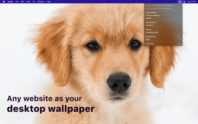
Plash
Description Make any website your desktop wallpaper.This enables you to have
Swift3522mit
10 months ago
active-desktopappdesktop-wallpaper

shared-row
This is an open data specification for describing the right-of-way (ROW) for str
17other
3 years ago
dataright-of-wayrow

Complete_Street_Rule
The Complete Street Rule for ArcGIS CityEngine is a scenario oriented design too
Python182apache-2.0
2 years ago
arcgis-cityenginecgacityengine

FoodTrucks
:truck: San Francisco's finger-licking street food now at your fingertips.
JavaScript425
2 years ago
dockerdocker-curriculumjavascript

sharedstreets-ref-system
Making maps connectable: stable, non-proprietary IDs and data standards for stre
186mit
2 years ago
open_street_map
Experimental packages for ROS access to Open Street Map information
Python81
2 years ago

SQUID-Syracuse-Dashboard
Visualizing the streets condition in the city of Syracuse, NY
Python19
2 years ago

react-native-launch-navigator
Description Navigate your world faster and easier with Google Maps. Over 220
Java144
2 years ago
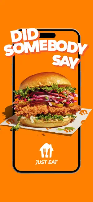
Skopelos
Description With the JustEat app, you can order whatever you love, wherever y
Swift237mit
2 years ago
coredatacoredatastackios

react-native-accordion
Description Transit is your real-time urban travel companion. Open the app to
JavaScript437
6 years ago

awesome
Description PBS KIDS Games makes learning fun & safe with 250+ educational ga
532cc0-1.0
2 years ago
awesomeawesome-listcraft